The Metro Manila Concept
 |
| Political map of Metro Manila Photo courtesy of Wikipedia |
And so, the Metro Manila was created. Is that it, the original concept?
Unfortunately not. Metro Manila is like a metropolis of many layers. The modern Metro Manila is not the first, and if it continues to develop, it would likely not be the last.
 |
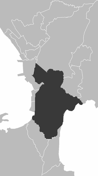
| Extent of the Kingdom of Namayan at its peak Photo courtesy of Wikipedia |
In 1335, a son of Raden Wijaya and a Manila noblewoman turned empress of Wijaya's Madjapahit Empire, which was centered in Java (now part of Indonesia), established the Kingdom of Namayan, which encompassed half of the modern City of Manila up to the Laguna de Bai (Laguna de Bay). In those times, the Philippines was divided into several small principalities called barangays which amounted only around 30 to 100 families (assuming each family had four members, 120 to 400 people). At times of war or emergency, a number of barangays team up into a confederation, with a pangulo heading the newfound coalition. After the war or crisis, they break up again. What makes Namayan stand out is that it comprised of more than six barangays, which meant it would have around 700 to 2,500 people under its fold, and it is permanently united under one ruler, which is quite unlike the confederations that recognize unified leadership when they combined their turfs for limited durations of time. Namayan, covering around a fraction of today's Metro Manila, survived another two centuries before being outshone by the Kingdoms of Tondo and Maynila, both of which had better locations for maritime trade since they both face the calm Manila Bay. Tondo is way older than Namayan, since it was mentioned in the Laguna Copperplate Inscription (LCI) as Tundun, around the year 900. One theory here is that Tondo was reduced in influence in the area when Namayan power rose in the region. But as for Maynila, the emerging kingdom is newer than both Tondo and Namayan, and the most famous ruler we know of this polity was Rajah Sulayman (Raha Soliman).
| Map of the Province of Manila |
The City of Manila today, meanwhile, owes much of her territorial extent today to the Americans, which extended the city outside Intramuros (also known as the Walled City, it featured one of the first stone forts in Asia). Manila, the Ever Loyal City, only extended inside Intramuros for most of the Spanish colonial rule. Some of the suburbs only began to be incorporated after the 1863 Corpus Christi earthquake, which forced the Captain General to transfer his residence outside Intramuros. That is, the Malacañang (or Malacañan) Palace. Through American initiatives after the Spanish era, the completion of today's City of Manila is well under way to what it is today.
As it goes, Metro Manila (or NCR, the National Capital Region) and the City of Manila should not be confused with, today or in her history. The former owed its history to Namayan and the Province of Manila, while the latter owed its history to Sulayman's kingdom and the Ever Loyal City. Besides, the current Philippine Constitution offers a distinction as well:
Manila shall be the capital of the Republic of the Philippines, and the area designated as Metro Manila shall be the seat of national government.
Thus, do not fret whenever you do not see the Senate of the Philippines (which is located in Pasay City) nor the House of Representatives (which is located in Quezon City) in the City of Manila (wherein the palace of the President is still located), because even though it is the capital of the Philippine Republic, Metro Manila shall still be the seat of national government.


would you have maps or images where the territories of the former namanyan, tondo and manila kingdoms where? also, those of the visayan kingdoms..?
ReplyDelete